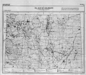
Where was oil found in Colorado in the early days of the automobile? How do different parts of the state compare in oil and gas production based on geological epochs? A 1925 map (reprinted in 1984) from the Colorado Geological Survey answers these questions and more. Although the early map did not use color, it instead used shading to indicate the various geological time periods (Tertiary, Cretaceous, Triassic/Jurassic, Paleozoic) and symbols to indicate oil fields, gas and oil seeps, anticlines, bitumen, deep water wells, and other relevant information. This interesting look into the early years of oil and gas production has been digitized and is available online from our library. Visit our web catalog for further resources.
Latest posts by Amy Zimmer (see all)
- How to Spot the Differences Between Eagles and Hawks - August 16, 2021
- How Transportation Projects Help Tell the Story of Colorado’s Past - August 9, 2021
- Time Machine Tuesday: The Night the Castlewood Canyon Dam Gave Way - August 3, 2021
