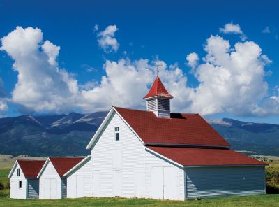
Our series travelling Colorado’s Scenic and Historic Byways continues along Frontier Pathways! The Frontier Pathways Scenic and Historic Byway follows the footsteps of indigenous communities, European explorers, fur trappers, miners, pioneers, and many more across south-central Colorado.

Frontier Pathways is a 103-mile wishbone-shaped, paved route starting in Pueblo and ending in Colorado City. Along the way, Frontier Pathways climbs 4,800 feet from the plains up into the Sangre de Cristo Mountains, through spectacular natural areas and past numerous historical sites. Frontier Pathways was designated as Scenic and Historic Byway in 1994 and earned the further distinction of being named an America’s Byway by the U.S. Secretary of Transportation in 1998. According to the Frontier Pathways Corridor Management Plan, the area was selected for this honor in order to “showcase an outstanding scenic and historic touring route.” This plan is worth a closer look for its detailed information about each section of the Byway, its ecological zones, and historical sites.
The area around Frontier Pathways is particularly interesting for its history as part of Colorado’s Southern Frontier, which is detailed in a 1984 report by the Colorado Office of Archaeology and Historic Preservation. This report focuses on European exploration and occupation of the land that is now Colorado’s southern border, starting with the Spanish in 1664, and goes on to explain how the United States came to settle the region. Highlights of Frontier Pathways like the Arkansas River, trading fort sites, and hundred-year-old ranches are featured in the story of this area.
Those driving along Frontier Pathways will follow in the footsteps of two well-known figures in Colorado’s history. The first is Zebulon Pike, who led an 1806 US Army expedition along the Arkansas River and attempted, unsuccessfully, to climb the mountain now called Pikes Peak in his honor. His route, like Frontier Pathways, followed the Arkansas River through Pueblo and into the Wet Mountain Valley. He noticed an abundant beaver population in this area, and his reports inspired fur trappers and traders to flock to the area, joining the Ute and Jicarilla Apache who had been hunting in the region for centuries.
The second historical figure is Arthur Carhart, a landscape architect for the US Forest Service. Carhart is credited with developing the concept of car camping by building roads and automobile-accessible campgrounds on Forest Service land. In 1919, he planned Colorado State Highways 165 and 96 as the country’s first scenic and recreational roads; these highways now form the modern Frontier Pathways Scenic and Historic Byway. You can read more about Carhart in the biography Arthur Carhart: wilderness prophet by Tom Wolf, available to check out from the State Publications Library.
Whose footsteps would you like to retrace along the Frontier Pathways Scenic and Historic Byway?
- Colorado’s Governors: Raymond H. Talbot - January 10, 2025
- Digital Repository Top 5: the most popular newly digitized materials of 2024 - December 30, 2024
- Colorado’s Scenic and Historic Byways: Gold Belt - December 6, 2024